NEW WEBSITE COMING SOON! |
|
|---|
Below are the available original antique maps of Italy |
RARE AND ANTIQUE MAPS OF ITALY (page 3 of 3) |
||||||||
|---|---|---|---|---|---|---|---|---|
(click image for more information, and/or to purchase the map ) |
Title / Publisher / Atlas or publication
Place (Date of publication) Size in inches |
|||||||
|
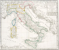
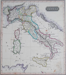
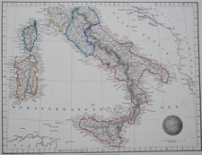
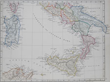
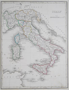
ITALY-26 |
Italiae Antiquae C. F. Delamarche Paris, 1809 (1809-1818) approx. 19 1/4 x 13 1/4 inches |
|||||||
|
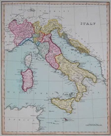
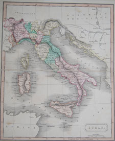
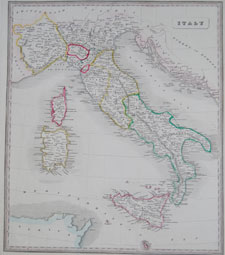
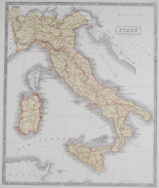
ITALY-27 |
Italy Ellis's General Atlas of the World, with the Latest Discoveries and the Continental Alterations London, 1811 approx. 10 1/2 x 13 1/4 inches
|
|||||||
|
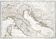
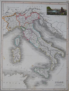
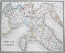
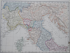
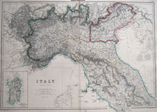
ITALY-28 |
Partie Septentrionale de l'Italie C. F. Delamarche Paris, 1816 (1818) approx. 19 1/4 x 13 1/4 inches |
|||||||
|
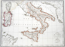
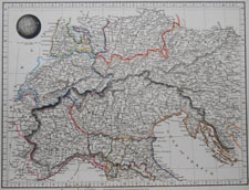
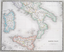
ITALY-29 |
Royaumes de Naples, Sicile et Sardaigne C. F. Delamarche Paris, 1812 (1818) approx. 19 1/4 x 13 1/4 inches |
|||||||
|
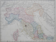
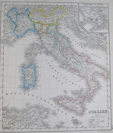
ITALY-30 |
Italy Ewing's New General Atlas Edinburgh; Oliver and Boyd, publishers; 1817 approx. 8 3/4 x 11 1/4 inches
|
|||||||
|
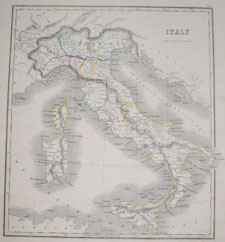
ITALY-31 |
Italy Dr. Brookes's General Atlas of Modern Geography London; William Darton, Mapseller at the Repertory of Genius; 1817 approx. 8 1/4 x 9 3/4 inches |
|||||||
|
ITALY-32 |
Italy [vignette of Rome] A General Atlas, containing Maps illustrating some important periods in Ancient History, and distinct Maps of the several Empires, Kingdoms and States in the World, From Original Drawings, according to the latest Treaties, by J. Wyld and Engraved by N. R. Hewitt Edinburgh, John Thomson & Co; London, Baldwin, Cradock & Joy; Dublin, John Cumming; 1819 approx. 10 x 13 3/4 inches
|
|||||||
|
ITALY-33 |
North Italy Outlines of the World by A. Arrowsmith, Hydrographer to His Majesty London; 1825 approx. 14 3/4 x 11 1/4 inches |
|||||||
|
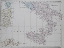
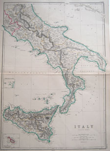
ITALY-34 |
South Italy Outlines of the World by A. Arrowsmith, Hydrographer to His Majesty London; 1825 approx. 14 3/4 x 11 1/4 inches |
|||||||
|
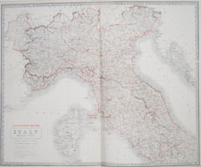
ITALY-58 |
North Italy New General Atlas Henry Teesdale and Co., London, 1831 approx. 18 3/4 x 15 1/4 inches |
|||||||
|
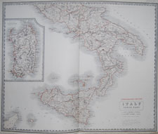
ITALY-59 |
South Italy New General Atlas Henry Teesdale and Co., London, 1831 approx. 18 3/4 x 15 1/4 inches |
|||||||
|
ITALY-35 |
North Italy Maps of the World by E.P. Williams Eton; 1841 approx. 13 1/2 x 10 3/4 inches |
|||||||
|
ITALY-36 |
Central Italy Maps of the World by E.P. Williams Eton; 1841 approx. 13 1/2 x 10 3/4 inches |
|||||||
|
ITALY-37 |
South Italy Maps of the World by E.P. Williams Eton; 1841 approx. 13 1/2 x 10 3/4 inches |
|||||||
|
ITALY-38 |
Italia Septentrionalis [North Italy] Maps of the World by E.P. Williams Eton; 1841 approx. 13 1/2 x 10 3/4 inches |
|||||||
|
ITALY-39 |
Italia Media [Central Italy] Maps of the World by E.P. Williams Eton; 1841 approx. 13 1/2 x 10 3/4 inches |
|||||||
|
ITALY-40 |
Italia Meridionalis [South Italy] Maps of the World by E.P. Williams Eton; 1841 approx. 13 1/2 x 10 3/4 inches |
|||||||
|
ITALY-41 |
Italy A New General Atlas... Thomas Johnson, Manchester; 1848 approx. 13 1/4 x 15 inches |
|||||||
|
ITALY-42 |
Italien Atlas der Erde und des Himmels Weimar; 1850 approx. 8 7/8 x 10 1/2 inches |
|||||||
|
ITALY-43 |
Italy General Atlas W.H. Lizars, London; circa 1850 approx. 8 7/8 x 11 1/4 inches |
|||||||
|
ITALY-44 |
Italy unidentified atlas George Boynton; mid-19th century approx. 10 x 12 3/4 inches |
|||||||
|
ITALY-45 |
Italy McPhun's Maps of the World 1863 approx. 14 x 16 1/2 inches
|
|||||||
|
ITALY-46 |
North Italy The National Atlas of Historical, Commercial, and Political Geography, constructed from the most recent and authentic sources by Alexander Keith Johnston, F.R.G.S., Honorary member of the Geographical Society Berlin, Geographer at Edinburgh in Ordinary To Her Majesty Edinburgh; 1849 approx. 25 1/2 x 20 1/2 inches |
|||||||
|
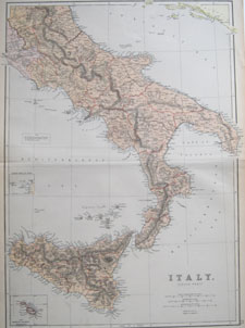
ITALY-47 |
South Italy The National Atlas of Historical, Commercial, and Political Geography, constructed from the most recent and authentic sources by Alexander Keith Johnston, F.R.G.S., Honorary member of the Geographical Society Berlin, Geographer at Edinburgh in Ordinary To Her Majesty Edinburgh; 1849 approx. 25 1/2 x 20 1/2 inches |
|||||||
|
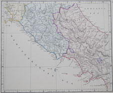
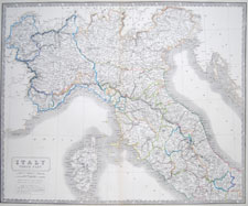
ITALY-56 |
"Italy — North Part" Alexander Keith Johnston The National Atlas of Historical, Commercial, and Political Geography... 1850 approx. 21 x 25 1/2 inches
|
|||||||
|
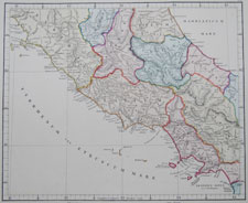
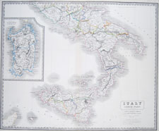
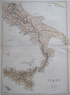
ITALY-57 |
"Italy — South Part" Alexander Keith Johnston The National Atlas of Historical, Commercial, and Political Geography... 1850 approx. 21 x 25 1/2 inches
|
|||||||
|
ITALY-48 |
Kingdom of Italy Fullarton's Royal Illustrated Atlas A. Fullarton and Co.; London and Edinburgh; 1860 approx. 23 1/2 x 19 1/4 inches |
|||||||
|
ITALY-49 |
Kingdom of Italy Fullarton's Royal Illustrated Atlas A. Fullarton and Co.; London and Edinburgh; 1860 approx. 23 1/2 x 19 1/4 inches |
|||||||
|
ITALY-50 |
Italy (South Part) The Imperial Atlas of Modern Geography Blackie and Son; London, Glasgow and Edinburgh; 1860 approx. 15 x 21 1/2 inches |
|||||||
|
ITALY-51 |
Italy (South Part) The Comprehensive Atlas & Geography of the World Blackie and Son; London, Glasgow, Edinburgh and Dublin; 1882 approx. 15 x 21 1/2 inches |
|||||||
|
ITALY-52 |
Italy (South Part) The Comprehensive Atlas & Geography of the World Blackie and Son; London, Glasgow, Edinburgh and Dublin; 1882 approx. 15 x 21 1/2 inches |
|||||||
|
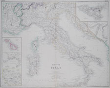
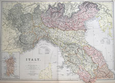
ITALY-53 |
Italy (North Part) The Imperial Atlas of Modern Geography Blackie and Son; London, Glasgow and Edinburgh; 1860 approx. 15 x 21 1/2 inches
|
|||||||
|
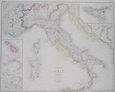
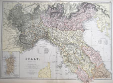
ITALY-54 |
Italy (North Part) The Comprehensive Atlas & Geography of the World Blackie and Son; London, Glasgow, Edinburgh and Dublin; 1882 approx. 15 x 21 1/2 inches |
|||||||
|
ITALY-55 |
Italy (North Part) The Comprehensive Atlas & Geography of the World Blackie and Son; London, Glasgow, Edinburgh and Dublin; 1882 approx. 15 x 21 1/2 inches |
|||||||
|
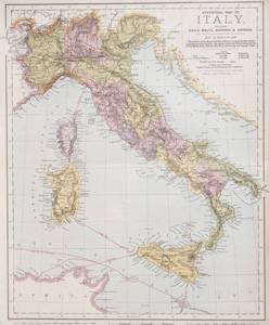
ITALY-60 |
Italy including Sicily, Malta, Sardinia & Corsica Letts's Popular Atlas 1887, London approx. 13.375 x 16.375 inches (34 x 41.5 cm)
|
|||||||
|
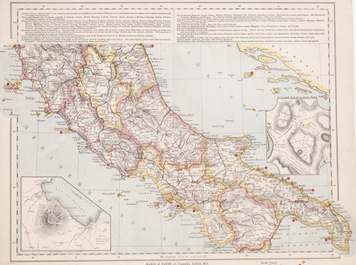
ITALY-61 |
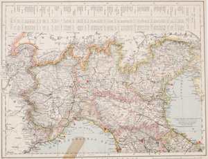
Italy (north, with insets of Bay of Naples and Mt Vesuvius and Ancient Rome] Letts's Popular Atlas 1887, London approx. 13.375 x 16.375 inches (34 x 41.5 cm)
|
|||||||
|
ITALY-62 |
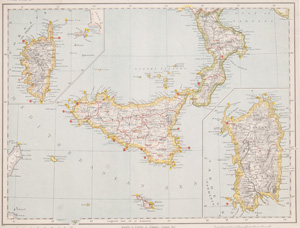
Italy (south, with Sicily and insets of Corsica and Sardinia) Letts's Popular Atlas 1887, London approx. 15.875 x 13 inches (40.5 x 33 cm)
|
|||||||
|
ITALY-63 |
||||||||
|
ITALY-64 |
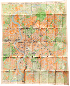
Stab. Arti Grafiche L. Salomone, Roma(1955)
about 26.25 x 32.125 inches (66.7 x 81.6 cm) fully unfolded
|
|||||||
|
||||||||