Since Adirondack Retro acquired Darvill's Rare Prints in August of 2022, we have been working tirelessly on our New State-Of-The Art Website. We are excited to announce that it is now up and running and that our massive inventory of Antique Prints and Rare Maps are being transferred over to the new site daily. In addition to the nearly 500,000 prints found on www.DarvillsRarePrints.com, Adirondack Retro offers an eclectic selection of Antique and Vintage Advertisements along with their Limited Edition Giclee Prints. During this transition, customers will still be able to shop and make purchases on www.DarvillsRarePrints.com.
Sign up for our Mailing List and receive our Adirondack Retro Newsletter. When you sign up, we will email you a coupon code for you to get 15% OFF your first order at AdirondackRetro.com.
Complete Handy Atlas
Published circa 1890 by Matthews-Northrup
Original color lithographs over 130 years old! NOT modern reproductions. Sheet size = approximately 5.5 x 8 inches
(Printed on both sides)
PLEASE CLICK ON THE THUMBNAIL IMAGES FOR AN ENLARGED VIEW.
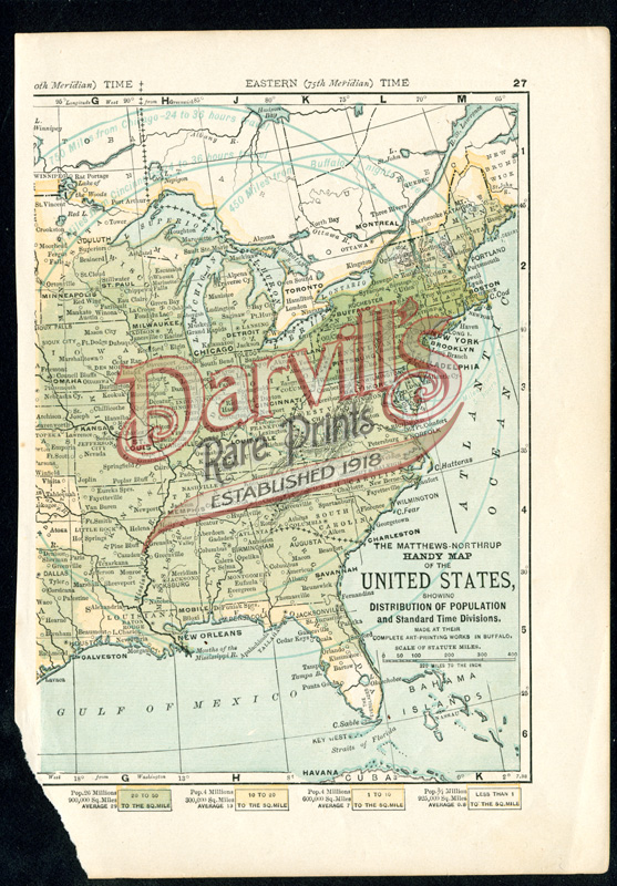
United States Showing Distribution of Population and Standard Time Divisions
SIDE A
p. 27
NOTE PAPER LOSS IN CORNER
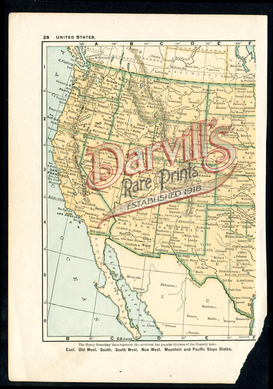
United States [Western half – see below for Eastern half]
SIDE B
p. 28
NOTE PAPER LOSS IN CORNER
$15
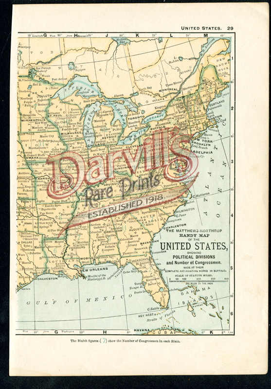
United States Showing Political Divisions and Number of Congressmen [Eastern half–see above for Western half]
SIDE A
p. 29
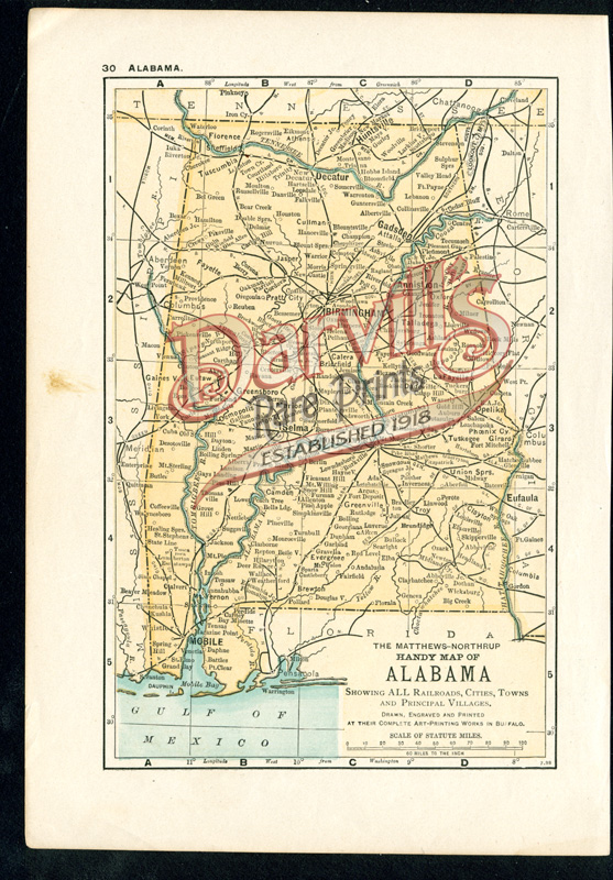
Alabama
SIDE B
p. 30
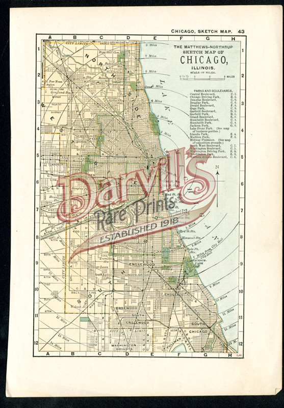
Chicago
SIDE A
p. 43
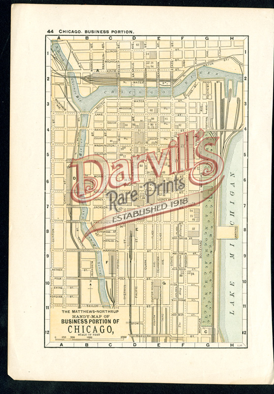
Chicago
SIDE B
p. 44
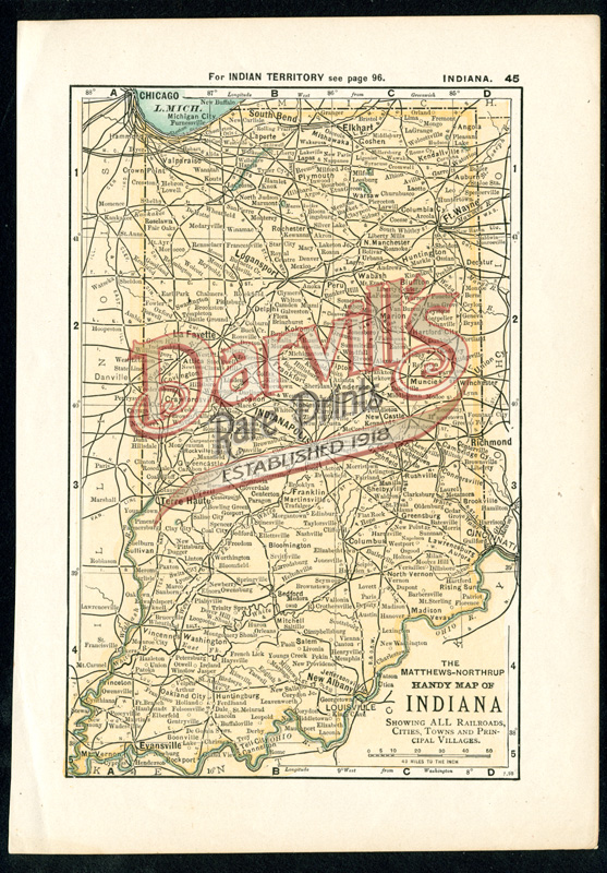
Indiana
SIDE A
p. 45
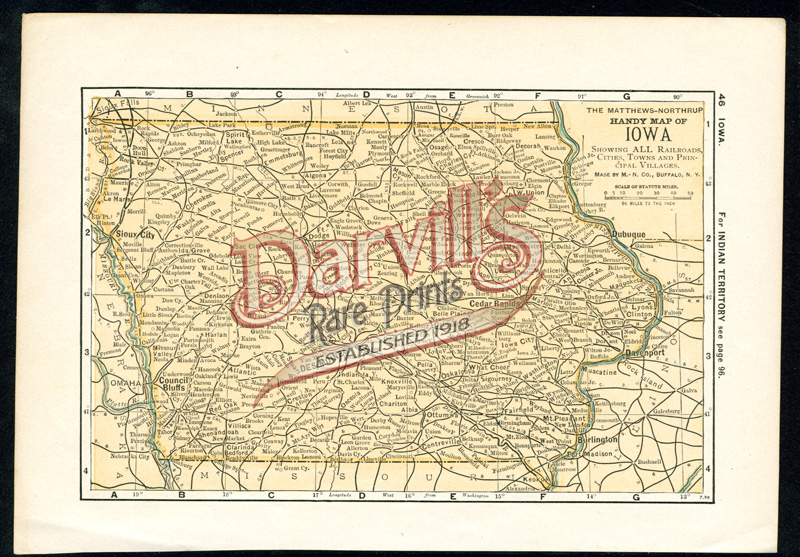
Iowa
SIDE B
p. 46
$15
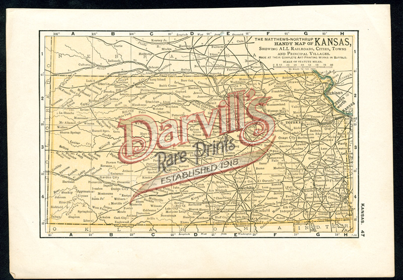
Kansas
SIDE A
p. 47
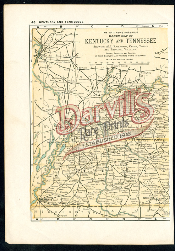
Kentucky and Tennessee
SIDE B
p. 48
$15
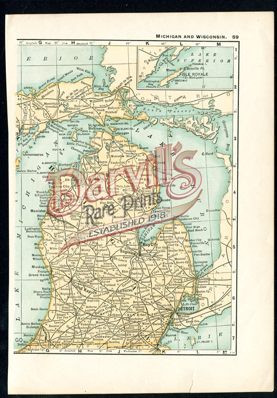
Michigan and Wisconsin
SIDE A
p. 59
NOTE TEAR IN BOTTOM MARGIN
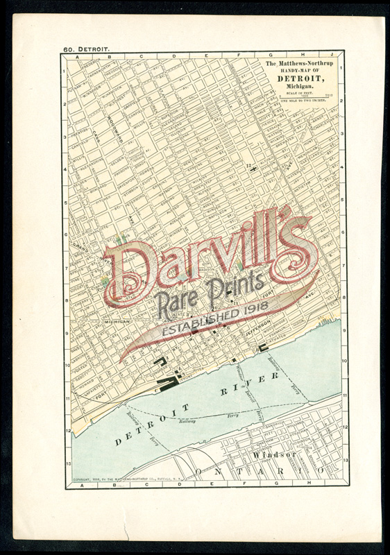
Detroit
SIDE B
p. 60
NOTE TEAR IN BOTTOM MARGIN
$15
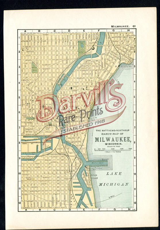
Milwaukee
SIDE A
p. 61
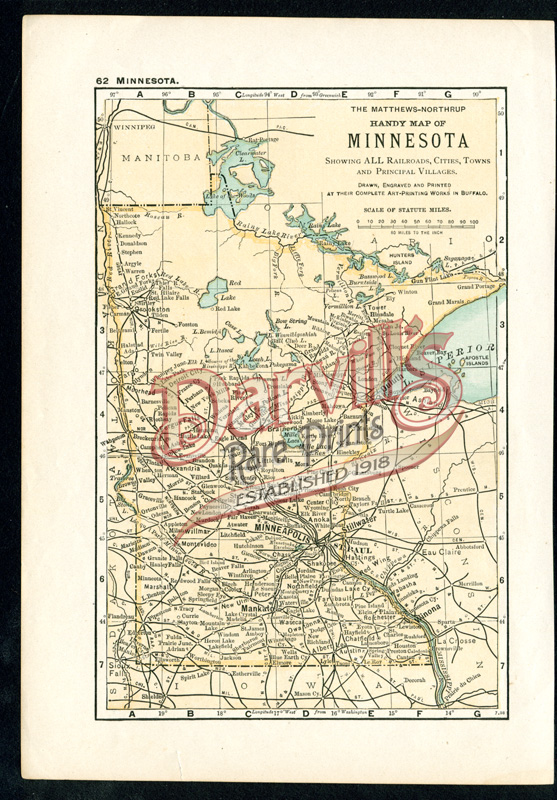
Minnesota
SIDE B
p. 62
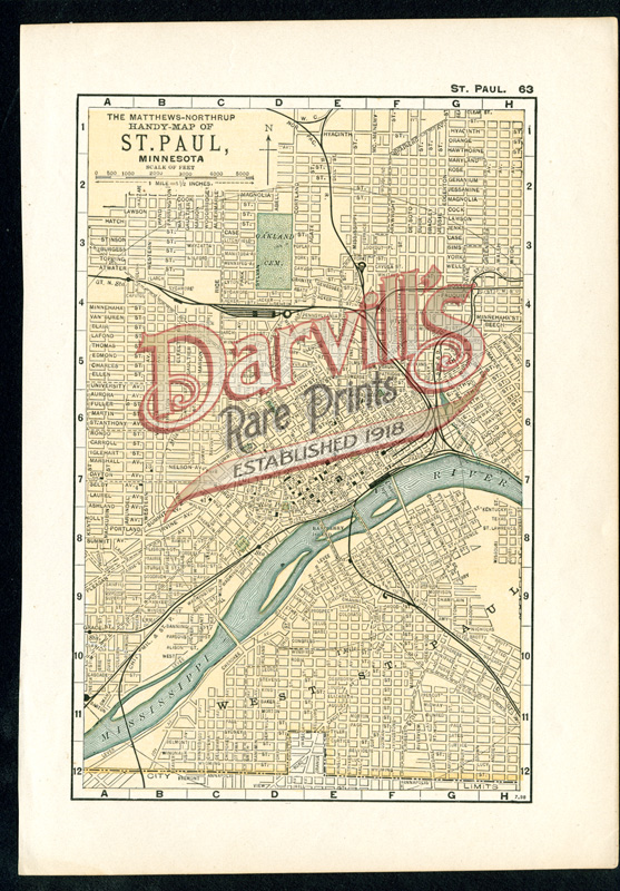
St. Paul
SIDE A
p. 63
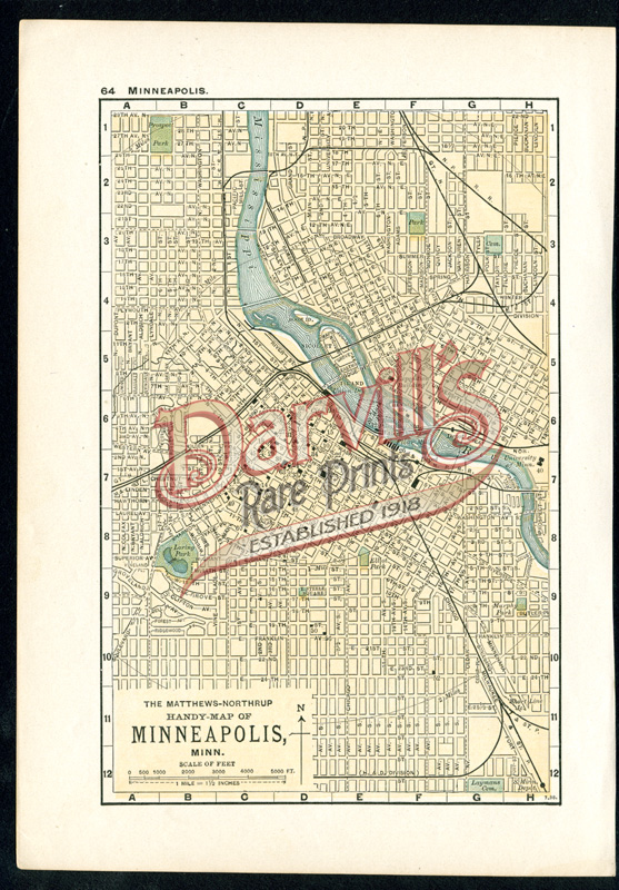
Minneapolis
SIDE B
p. 64
$15
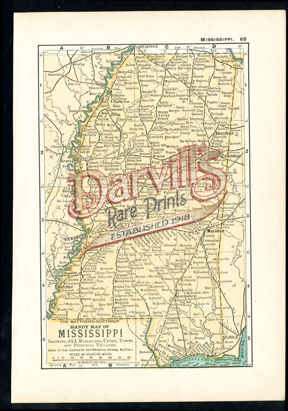
Mississippi
SIDE A
p. 65
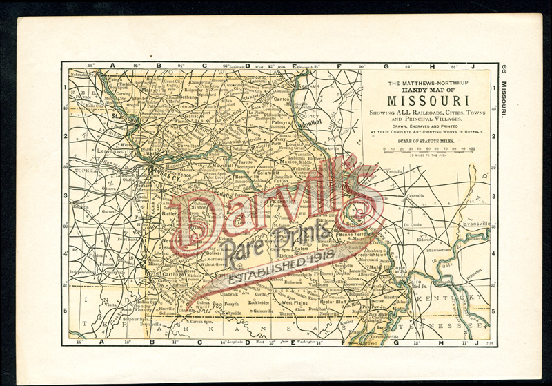
Missouri
SIDE B
p. 66
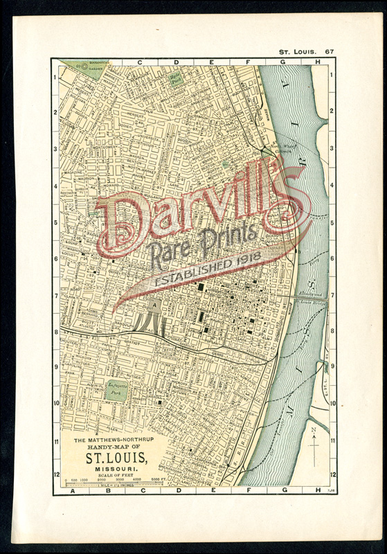
St. Louis
SIDE A
p. 67
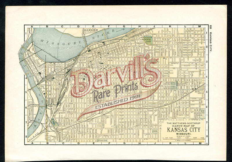
Kansas City
SIDE B
p. 66
$15
Rochester, New York
SIDE A
p. 81
Niagara Falls, New York
SIDE B
p. 82
$15
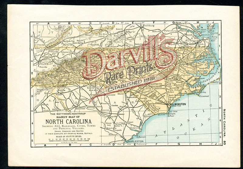
North Carolina
SIDE A
p. 83
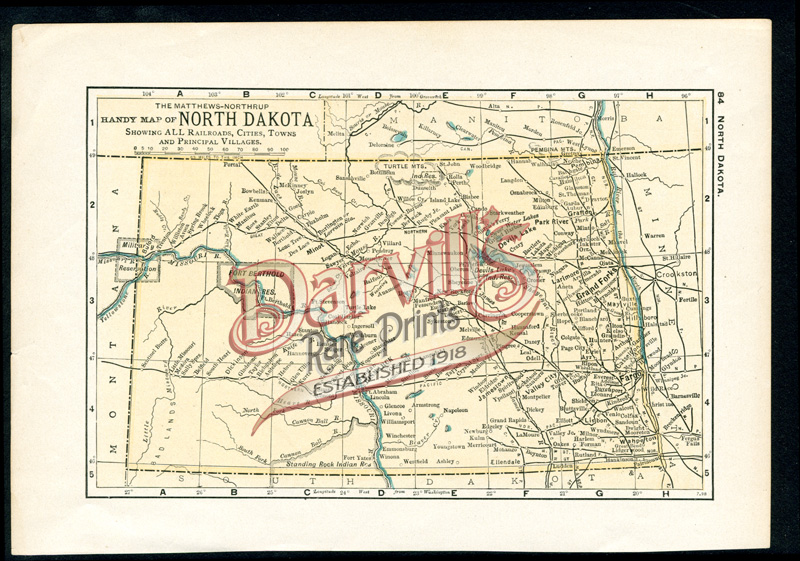
North Dakota
SIDE B
p. 84
$15
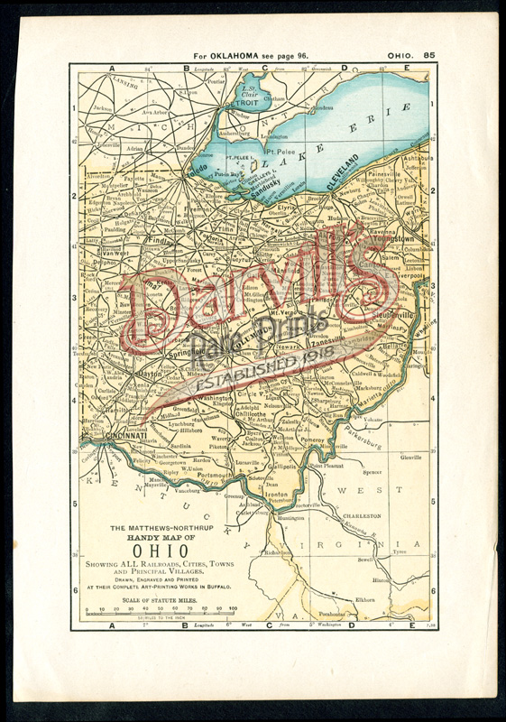
Ohio
SIDE A
p. 85
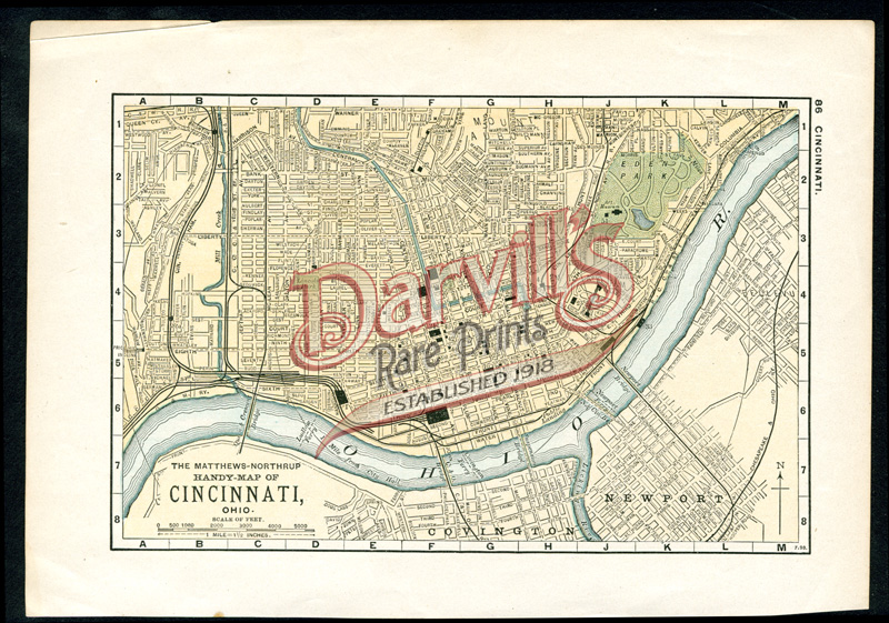
Cincinatti
SIDE B
p. 86
$15
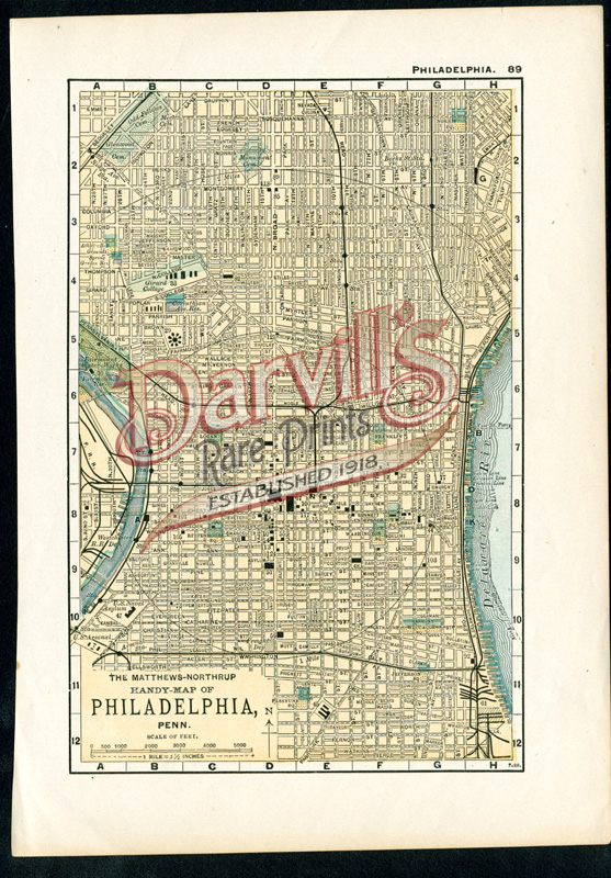
Philadelphia
SIDE A
p. 89
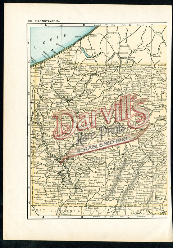
Pennsylvania
SIDE B
p. 90
$15
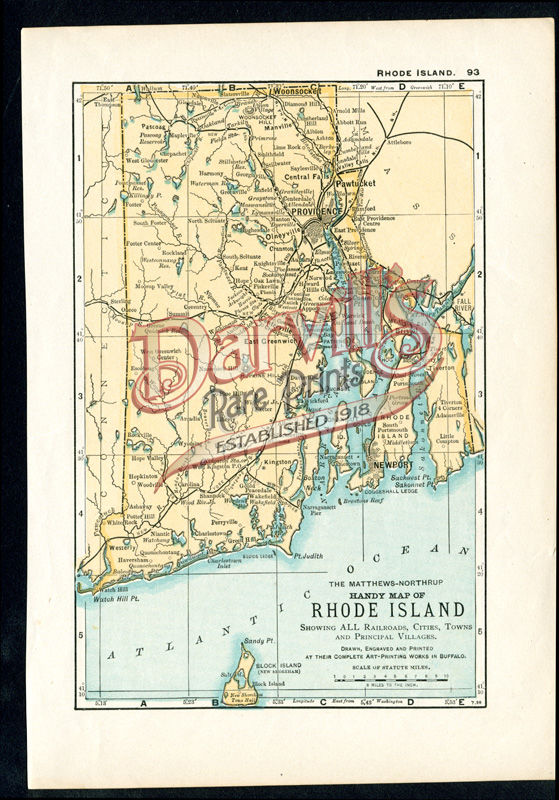
Rhode Island
SIDE A
p. 93
NOTE SHORT TEAR IN MARGIN
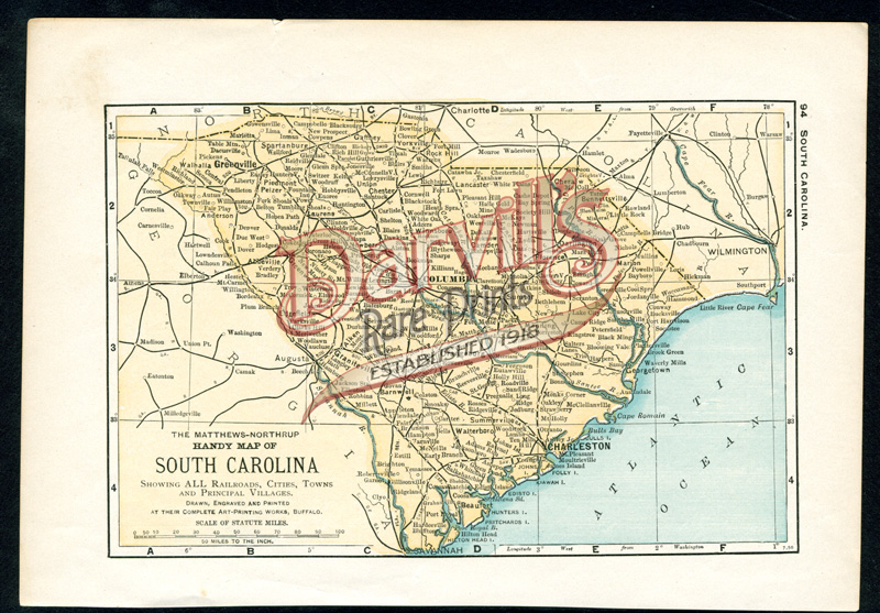
Rhode Island
SIDE B
p. 94
NOTE SHORT TEAR IN MARGIN
$15
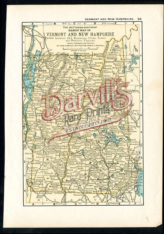
Vermont and New Hampshire
SIDE A
p. 99
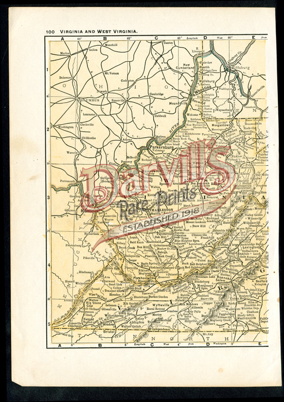
Virginia and West Virginia
SIDE B
p. 100
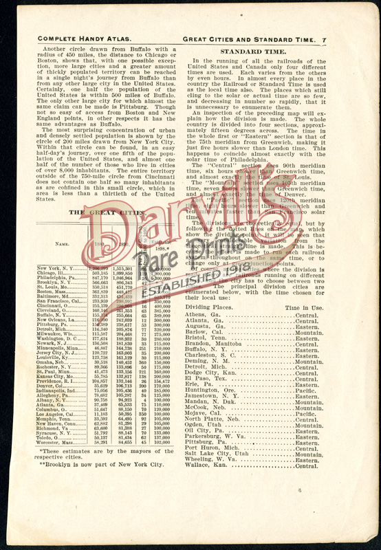
Great Cities and Standard Time
SIDE A
p. 7
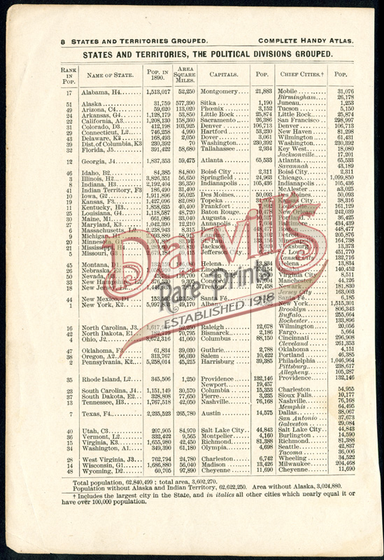
States and Territories, The Political Divisions Grouped